Key Takeaways
- >M7.4 earthquake (initially 7.8) in the Molucca Sea, ~120km from Ternate
- >Tsunami warnings issued for Indonesia, Philippines, and Malaysia
- >Maximum 75cm waves recorded along Maluku coastal areas
- >1 death from building collapse in Manado, North Sulawesi
- >Tsunami warning lifted approximately 2 hours after the quake
Earthquake Overview
Earthquake Intensity Scale
Initially measured at 7.8 by USGS, later revised to 7.4 — still classified as a major earthquake
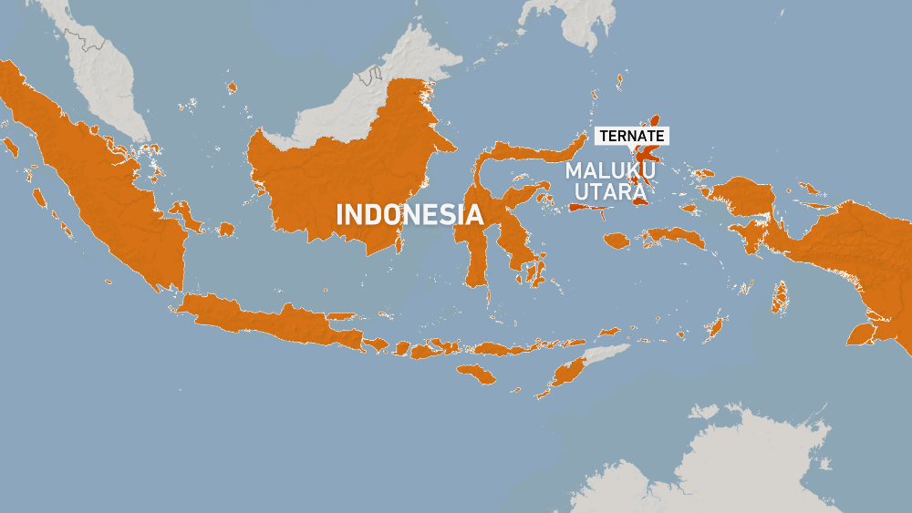
On April 1, 2026, a powerful magnitude 7.4 earthquake struck the Northern Molucca Sea, approximately 120 kilometers northeast of Ternate. According to Al Jazeera, Indonesia's meteorological agency (BMKG) immediately issued tsunami warnings for multiple countries in the region.
The USGS initially recorded the earthquake at magnitude 7.8, later revising it down to 7.4. The hypocenter was located at a depth of 35 kilometers — an intermediate depth, meaning the shaking was felt over a wide area but the energy was somewhat attenuated before reaching the surface. Nonetheless, residents across the Maluku region, North Sulawesi, and neighboring provinces reported strong shaking lasting several seconds.
→ Indonesia experiences 6,000–7,000 earthquakes per year on average, but an M7.4+ event remains extremely rare and dangerous.
Tsunami Response
Immediately following the earthquake, BMKG issued tsunami warnings for Indonesia, the Philippines, and Malaysia. According to France 24, small waves were recorded along several coastal areas, with the maximum height reaching 75cm above normal tide levels. The tsunami did not cause significant infrastructure damage.
Approximately two hours after the main earthquake, all tsunami warnings were lifted. The Pacific Tsunami Warning Center confirmed that all threats had passed. However, authorities advised coastal residents to remain vigilant as aftershocks could continue to occur.
→ Indonesia’s tsunami warning system responded rapidly — within just 5 minutes of the earthquake, warnings were broadcast nationwide.

Photo: Al Jazeera
Impact and Casualties
One person was killed when a building collapsed in Manado, the capital of North Sulawesi province. According to 1News, strong shaking was felt across multiple provinces surrounding the epicenter, including Maluku, North Maluku, and Gorontalo.
The low death toll was fortunate given the earthquake’s magnitude. Several factors contributed to the limited casualties: the 35km depth of the hypocenter helped dissipate energy, and the epicenter was located offshore. However, authorities continued to conduct structural assessments of buildings in the area and reinforce damaged infrastructure.
→ For comparison: the 2018 Sulawesi earthquake was M7.5 but shallower and closer to shore — it killed over 4,300 people.
Event Timeline
Epicenter approximately 120km from Ternate at 35km depth. USGS initially recorded 7.8, later revised down to 7.4.
Indonesia meteorological agency (BMKG) issues tsunami warning for Indonesia, Philippines, and Malaysia.
Small tsunami waves recorded in several coastal areas of the Maluku region, up to 75cm above normal tide levels.
A building collapses in Manado, North Sulawesi, killing one person. Strong shaking felt across the region.
BMKG and Pacific Tsunami Warning Center confirm all threats have passed.
Multiple aftershocks recorded, strongest measuring 5.0. Residents advised to remain vigilant.
Photo: Al Jazeera
Ring of Fire Context
Indonesia sits at the convergence of several major tectonic plates, including the Pacific, Eurasian, and Indo-Australian plates. This position makes Indonesia one of the most seismically active countries in the world, with thousands of earthquakes recorded annually.
Indonesia’s earthquake history includes some of the world’s most devastating disasters: the 2004 Indian Ocean tsunami (M9.1, over 230,000 deaths), the 2018 Sulawesi earthquake and tsunami (M7.5, over 4,300 deaths), and the 2018 Lombok earthquakes. The tsunami warning system has been significantly upgraded since the 2004 disaster.
→ 275 million Indonesians live on one of Earth’s most geologically unstable regions — preparedness is a matter of survival.
Aftershocks and Ongoing Risk
In the hours following the main earthquake, multiple aftershocks were recorded, with the strongest measuring magnitude 5.0. Indonesia’s meteorological agency advised residents in affected areas to remain vigilant and avoid staying in damaged buildings.
Seismologists note that major earthquakes are typically followed by aftershock sequences lasting from days to weeks. While most aftershocks will be weaker than the main event, there remains a small probability of an equal or stronger aftershock. Residents are advised to prepare evacuation plans and monitor official announcements.
→ A 5.0 aftershock can cause further damage to already-weakened structures — residents should inspect their buildings for safety.